C2MS
Command-and-control for a private military operator
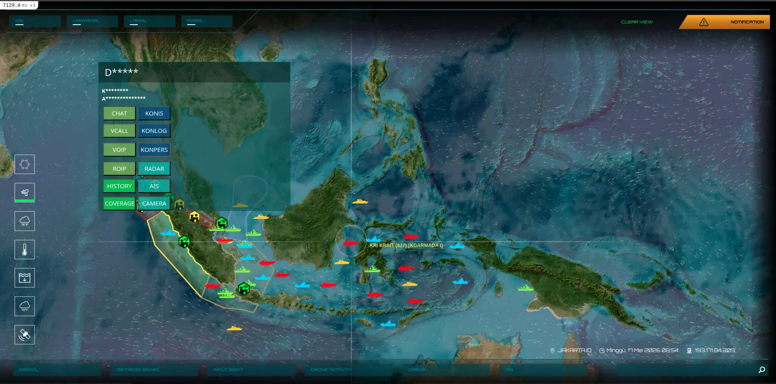
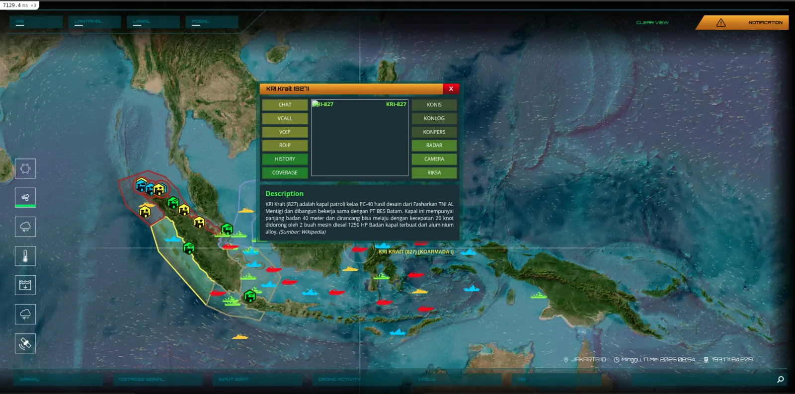
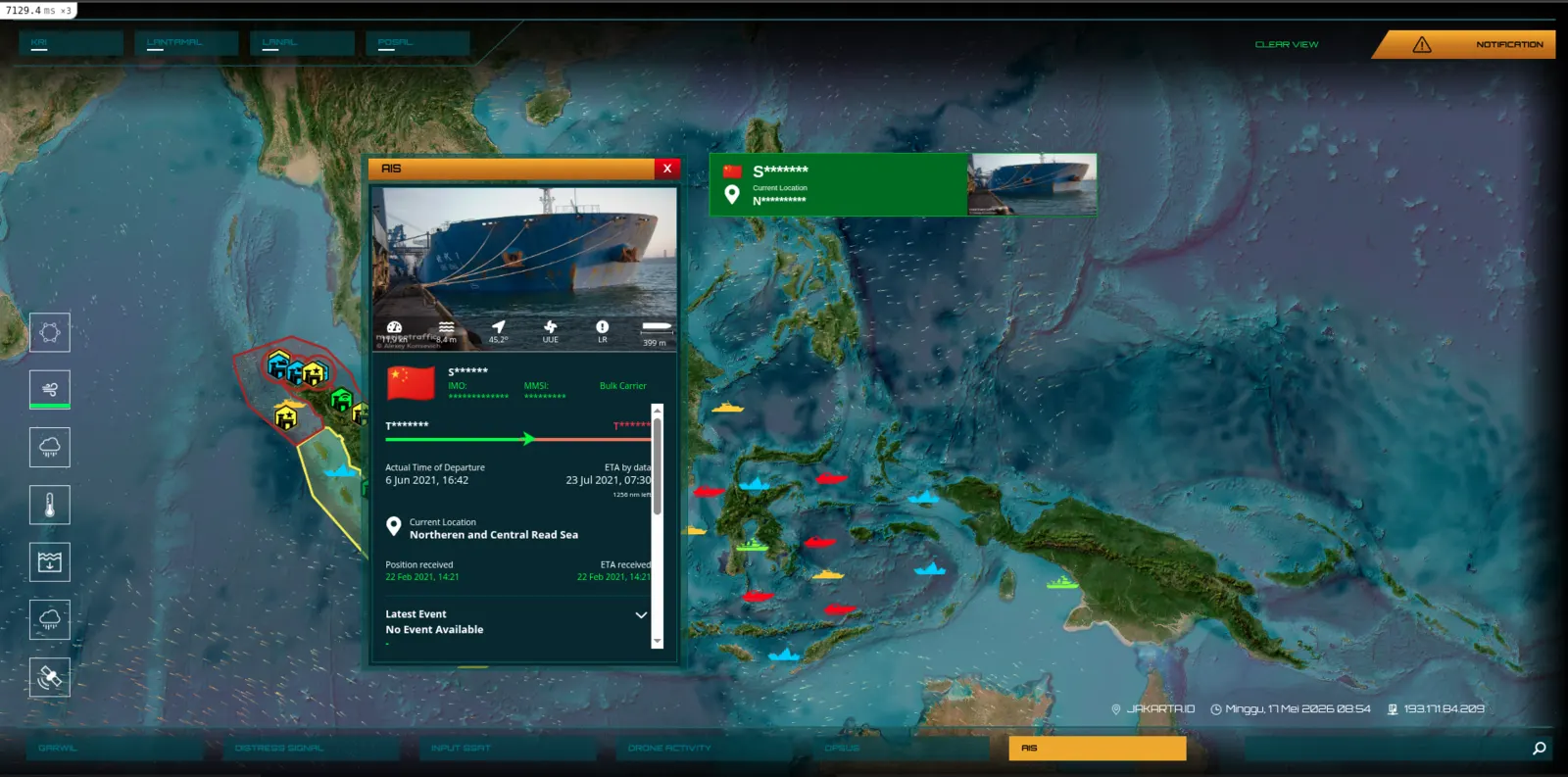
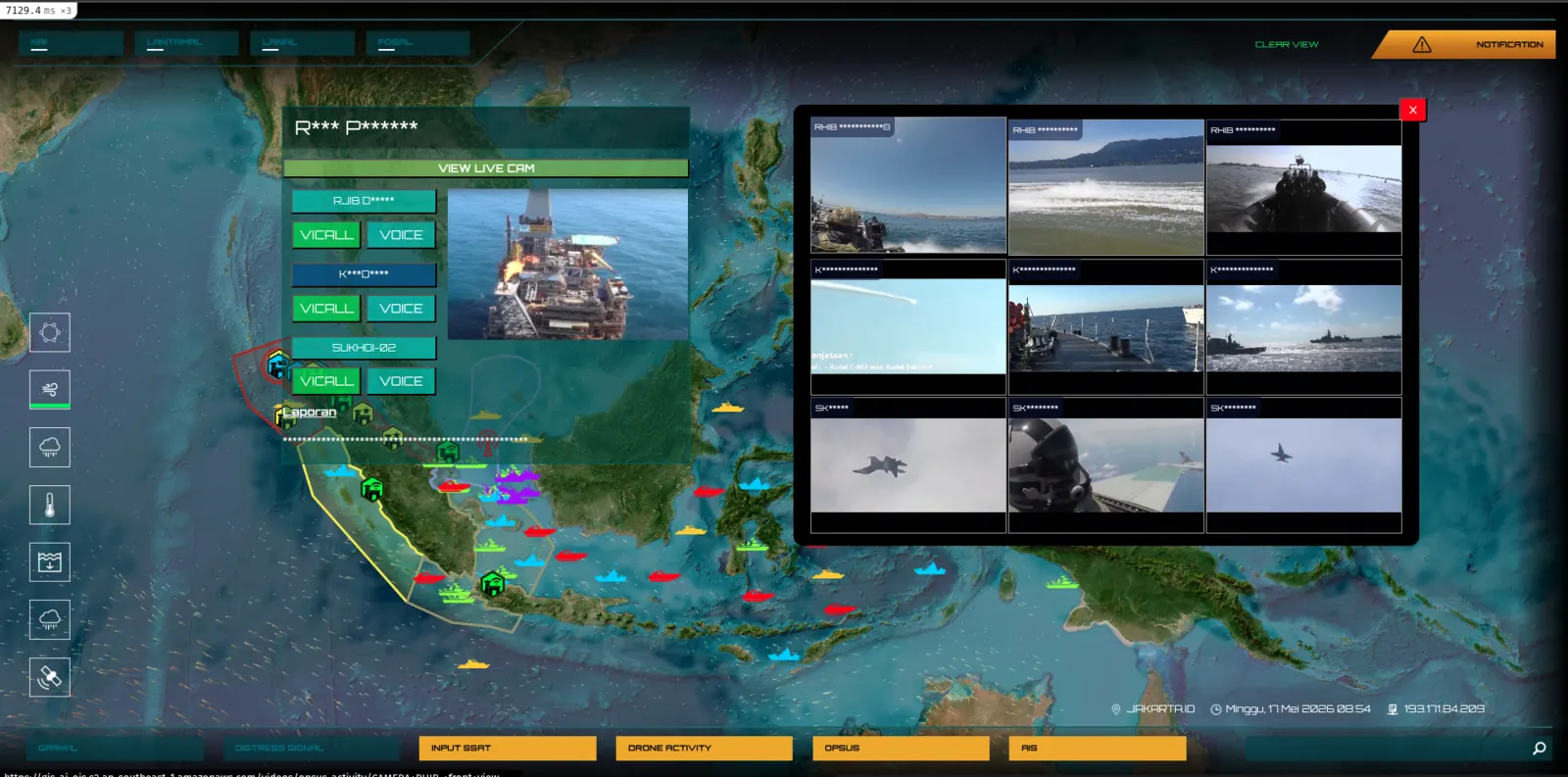
A geospatial intelligence platform serving a private military operator across the Indonesian archipelago. Real-time asset tracking, tactical layers, reconnaissance imagery, mission ops — built to run under operational duress, deployed across a country of seventeen thousand islands.
What we built
- Geospatial command dashboard with live unit positions
- Multi-layer tactical overlays + mission timelines
- Reconnaissance imagery and intelligence briefing tools
- Offline-first design for austere field deployments
Outcomes
- 17,000+ islands of operating theatre coverage
- Real-time unit tracking under intermittent connectivity
- Multi-team coordination across a single common operating picture
Stack
Screens
Have a system you want engineered well?
Wellcode.IO has been building software for Indonesia's institutions since 2015. Whether you need a full engineering team, a strategic partner, or just want to talk about a system you're stuck on — we'd love to hear from you.